Content created: 1993-12-26
File last modified:
It is a pet peeve of mine that most textbooks use geographical terms that are not found on the maps they provide. This file contains very simple outline maps of China and Taiwan with the names of Chinese provinces and of Taiwan counties.
If you would like to print out a reference copy of either map, click on it to get a page with the map alone.
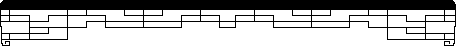
Chinese Provinces, Discontinued Names, Taiwan Counties Taiwan Detail
This map covers most of China. The abbreviations used are official and represent province, "autonomous region," and municipality names. In a very small number of cases, these do not represent full Pinyin spellings, which are therefore given separately (and with tones)."Obsolete Postal" spellings are those used for roughly a century before Pinyin was fully universalized. They continue to be used by a few, largely elderly authors and in Taiwan.
It may seem an inconvenience to have the map itself labeled with the abbreviations rather than the full names, but it allows the map to do double-service as a learning device. After you have become initially familiar with these names, you can use the map to test yourself on their locations, which turns out to be a very effective way to connect the arbitrary names with specific areas.
Click on the map to toggle major rivers on and off. Click here for a larger copy of the map.

| Abbr. | Official Spelling | Chinese | Old Postal |
|---|---|---|---|
| AH | Anhui | Ānhuī 安徽 | Anhui |
| BJ | Beijing | Běijīng 北京 | Peking, Pekin, Peiping |
| FJ | Fujian | Fújiàn 福建 | Fukien |
| GD | Guangdong | Guǎngdōng 广东 | Kuangtung |
| GS | Gansu | Gānsù 甘肃 | Kansu |
| GX | Guangxi | Guǎngxī 广西 | Kwangsi |
| GZ | Guizhou | Guìzhōu 贵州 | Kweichow |
| HA | Hainan | Hǎinán 海南 | Hainan |
| HB | Hubei | Húběi 湖北 | Hupei, Hupeh |
| HEB | Hebei | Héběi 河北 | Hopei, Hopeh |
| HEN | Henan | Hénán 河南 | Honan |
|
|
Special municipalities that were too small to fit on this map include:
The following province names are no longer in use. The territories that they covered have now been assimilated into other units. Most of these changes occurred after 1949, however, and are not recognized by the government in Taiwan, where most maps and other sources continue to use the earlier boundaries and names. This table may be of help if you read a source that refers to a province that cannot be found in the list above.
During the Communist period (period 23), JL was enlarged to include parts of adjacent provinces; LN was enlarged to include parts of adjacent provinces; HAI was created in 1987 from part of GD.
| Chinese | Obsolete Postal Spelling | Location |
|---|---|---|
| Āndōng 安東 |
Antung | Split between LN and JL |
| Cháhā'ěr 察哈爾 |
Chahar | Assimilated into NM |
| Héjiāng 合江 |
Hokiang | Assimilated into HL |
| Liáoběi 遼北 |
Liaopei, Liaopeh | Split between NM and JL |
| Měnggǔ 蒙古 |
Mongolia | "Outer Mongolia" (Wài Měnggǔ 外蒙古蒙) refers to the region that gained independence in 1921 as the Mongolian People's Republic. "Inner Mongolia" (Nèi Měnggǔ 內蒙古) is NM. Chinese governments until 1949 claimed that all of Mongolia was part of China. (This is still the official position of the ROC, period 22.) |
| Nènjiāng 嫩江 |
Nunkiang | Assimilated into HL |
| Rèhé 熱河 |
Jehol | Partly assimilated into NM |
| Sōngjiāng 松江 |
Sungkiang | Split between JL and HL |
| Suīyuǎn 綏遠 |
Suiyuan | Assimilated into NM |
| Xīng'ān 興安 |
Shing'an | Assimilated into NM |
| Xīkāng 西康 | Hsikang | Split between XZ and SC |
| Zhílì 直隸 |
Chihli | "To be under immediate jurisdiction," the Qīng 清 (period 21) name of HE. |
For more detail on Taiwan, click here.
This map covers Táiwān 臺灣 (台湾), including the Pescadores islands in the Taiwan Strait (constituting Pénghú County). The abbreviations used are not official; they are my own invention. As with the previous map, they allow this one to serve as an exercise in addition to being a reference. They represent the following county and municipality names:

| Counties (Xiàn) | |||
|---|---|---|---|
| Abbr. | Pinyin | Official Postal | |
| GX | Gāoxióng 高雄 | Kaohisung | |
| HL | Huālián 花蓮 | Hualien | |
| IL | Yílán 宜蘭 | Ilan | |
| JY | Jiāyì 嘉義 | Chiayi | |
| ML | Miáolì 苗栗 | Miaoli | |
| NT | Nántóu 南投 | Nantou | |
| PD | Píngdōng 屏東 | Pingtung | |
| PH | Pénghú 澎湖 | Penghu | |
| TB | Táiběi 臺北 | Taipei | |
| TD | Táidōng 臺東 | Taitung | |
| TN | Táinán 臺南 | Tainan | |
| TY | Táoyuán 桃園 | Taoyuan | |
| TZ | Táizhōng 臺中 | Taichung | |
| XZ | Xīnzhú 新竹 | Hsinchu | |
| YL | Yúnlín 雲林 | Yunlin | |
| ZH | Zhānghuà 彰化 | Changhua | |
| Municipalities (Shì) | |||
|---|---|---|---|
| Abbr. | Pinyin | Official Postal | |
| GXS | Gāoxióng shì 高雄市 | Kaohsiung City | |
| JLS | Jīlóng shì 基隆市 | Keelong City | |
| TBS | Táiběi shì 臺北市 | Taipei City | |
| TNS | Táinán shì 臺南市 | Tainan City | |
| TZS | Táizhōng shì 臺中市 | Taichung City | |