Content created: 2011-07-15
File last modified:


It is a pet peeve of mine that most textbooks use geographical terms that are not found on the maps they provide.
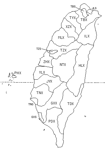
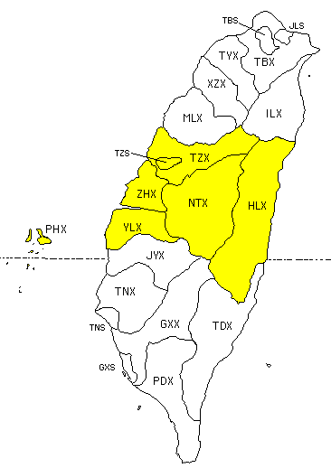
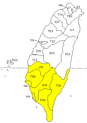
This map covers Táiwān 臺灣 / 台湾, including the Pescadores islands in the Táiwān Strait (constituting Pénghú Xiàn 澎湖縣 / 澎湖县).
The map shows county (xiàn 縣 / 县, Hokkien: koän) names and the names of municipalities (shì 市, Hokkien: chhï) that count administratively at the same level as counties or higher. (A listing of about 400 names of Taiwan administrative units is separately available [link].)
Táiběi City (TBS) and Gāoxióng City (GXS) have long been considered (in Táiwān) to be "special cities" with the equivalent of "provincial" administrative status (comparable to the province of Táiwān itself), and they are therefore no longer part of Táiběi Xiàn (TBX) and Gāoxióng Xiàn (GXX) respectively.
Táinán. In 2010, Táinán Xiàn (TNX) was absorbed into Tainan City (TNS), which formerly had itself been part of the xiàn, and the various townships (xiāng 鄉 / 乡, Hokkien: hiong) and zhèn 鎮 / 镇, Hokkien: tìn) within the county were converted to districts (qū 區 / 区, Hokkien: khu), which were further subdivided into neighborhoods (lǐ 里, Hokkien: lí), often corresponding to former villages, although the suffix lǐ was not usually added to their names. Like Táiběi and Gāoxióng, Táinán, made up of the old Táinán Xiàn and Táinán Shì, is now also considered a "special municipality," by area the largest of the three. The consolidation of TNX and TNS is NOT represented on this map, since most sources you are likely to read differentiate them.
Táiběi. By 2010 the population of Táiběi Xiàn exceeded that of Táiběi City, and the Xiàn was given independent city status under the Chinese name "New North City" (Xīnběi Shì 新北市 / 新北市). The official English name however is "New Taipei" rather than Xīnběi to avoid the "Communist" letter X.) As with Táinán, this change involved a cascade of changes as former townships became districts, &c. On this map and associated tables the older names are retained.
The three-letter abbreviations used on this map and elsewhere on this web site for Táiwān county and municipality names are not official; they are my own invention. As with the China map, they allow this one to serve as an exercise in addition to being a reference.
The "postal" spellings are those most common in books about Táiwān. Since 1945 Táiwān's government has tried very halfheartedly to officialize several different Romanization systems, both for place names and more broadly. However, the main goal has always been to avoid using the mainland's now universal Pinyin system, and little effort was made in Táiwān to produce efficiency, consistency, or conformity, none of which are in evidence. Expect extreme variation!
Hokkien (Taiwanese) transcriptions on this page make slight compromises with standard spellings to facilitate computer handling. (Details) There is a good deal of dialect variation within Hokkien, even within Taiwan. For example, the city of Jīlóng is ke-lông or koe-lâng or ki-liông or ke-lâng depending upon the speaker. The pronunciations given here follow Guerrino Marescano's English-Amoy Dictionary (Taichung: Maryknoll Fathers, 1979), which lists Central Taiwan Hokkien pronunciations for all three-digit zip codes defined at the time of publication (pp. 857-862).

|
| ||||||||||||||||||||||||

|
| ||||||||||||||||||||||||