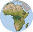
 Gombe National Park, Tanzania
 Gombe National Park, Tanzania
In 1960 Jane Goodall began research at Kakombe Valley (Kigoma District, Tanzania); Gombe National Park was established in 1968 and the Gombe Stream Research Center was founded in 1967. It is located on the eastern shore of Lake Tanganyika,15km north of the town of Kigoma and accessible only by boat. The park measures about 32km2, but may be significantly larger in actual surface area (36-60km2 appears in literature). The park lies between the lake and a rift escarpment on its eastern side, some 3-4km inland. Elevation ranges from 775m above sea level at the lake to 1500m along the escarpment. Its "...hills rise steeply from the lakeshore to the crest of the rift escarpment... Steep-sided valleys run from the escarpment down into the lake and these, in turn, are intersected by deep ravines draining from the ridges between the valleys" (Goodall, J.1986). Vegetation is a mix of grassland, open woodland, semideciduous forest and evergreen forest.
Research has focussed on the behavior of the Kakombe community of the eastern chimpanzee, Pan troglodytes schweinfurthii, with the Mitumba community (north end of park) being habituated in the early 1990s. Continuing studies of several troops of baboons (Papio anubis) began in the early 1970s. There have been shorter studies of red colobus monkeys (Colobus badius tephrosceles). Research has been concentrated in the central and (recently) northern portions of the Park; there is at least one unhabituated community of chimpanzees in the south. Total population has been estimated at roughly 150, but no census has been conducted. The chimpanzees were probably not genetically isolated from populations to the north through the 1980s, but gene flow has probably been restricted for some years and the population was effectively isolated by the 1990s.
The following chronology is modified from Teleki (1976) & Goodall (1986):
For additional information (including photos and updates on ongoing research at Gombe) see Discover Chimpanzees.
Primary source for the following Site Data is McGrew et. al. (1996), Great Ape Societies (Cambridge University Press), Appendix.
| Name: | Gombe Stream Wildlife Research Centre |
| Location: | Tanzania, Kigoma Region, 4° 40' S 29° 38' E; the Park is roughly a 12km x 2.5km strip on shore of Lake Tanganyika. |
| Status: | National Park |
| Area: | 32km2 |
| Altitude: | 775-1500m |
| Temp: | 19°C and 28°C |
| Rainfall: | 1600mm. Available data show marked changes in time: 1973-75, about 1600mm; 1976-1982, about 2500mm; 1983- 88, about 1500mm (rising slowly from drought in 1983, about 900mm). This variation is currently unexplained, but I'm working on it. |
| Vegetation (44K): | Evergreen riverine forest, deciduous dry forest, thicket, Miombo woodland, grassland, moorland |
|
Human influence: |
Provisioning, some wood cutting Disturbance ratings -- 2, 3, 1, 2, 3 |
|
Closest village: | At Park boundary |
|
Species studied: | P. t. schweinfurthii, Papio anubis (ongoing); shorter term on Colobus badius |
|
Population density (4K): |
Published estimates range from under 2 to over 6 individuals per km2 Click on link for listing of estimates. Central tendency seems about 4/km2 |
| Fauna (11K): | Click on link for list of mammals, herps, and invertebrates, or here for birds. |
|
Study period: | 1960-present |
| Habituation: | Excellent for Kasakela community, fair for Mitumba community |
|
Research presence: | Permanent |
| Conservation: | Tourism, conservation education in local schools |
|
Current research: | Long-term monitoring of individuals; mother-infant development |
| Methods: | Nest-to-nest follows, focal-subject sampling |
|
Contact person: | Dr. Anthony Collins, P.O. Box 185, Kigoma, Tanzania |
| Habitat photos | A selection of photos illustrating habitat |
| Maps | Tourist, Topo, and Field Maps |
| Aerial photos | Vertical and oblique photos of the Park |
| Bibliography | References for data found in this site, and other sources relating to Gombe (somewhat idiosyncratic selection). |
| Miscellaneous | Related links |