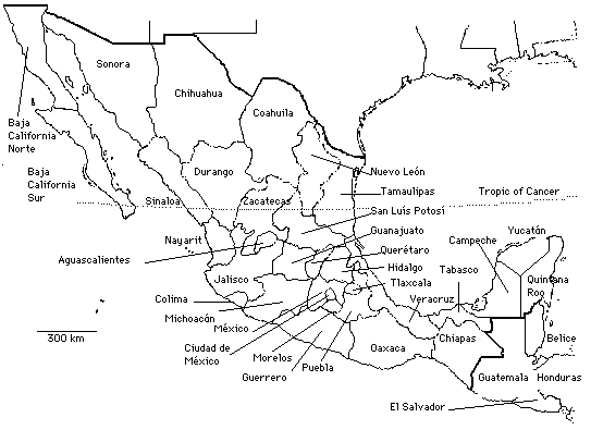
States of Modern Mexico With Mexico City in Green
(A larger copy of this map is linked at the top of every page of this essay.)
Content created: 2008-08-21
Part 1
Part 3
Modern Mexico covers three quite distinct areas. On the far west is the smallest region, the Baja California Peninsula (divided into the modern states of Baja California Norte and Baja California Sur). On the east is the Maya-speaking world, broadly everything lying east of the Isthmus of Tehuantepec (where the states of Oaxaca and Chipas meet), including the huge peninsula shared by Mexico with Guatemala and Belize. And in the middle is everything else. (A link at the top of every page will open a separate browser tab with a larger copy of the map shown here.)

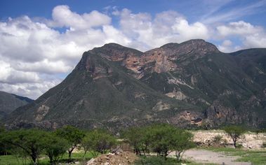
A few parts of Mexico are flat: the northern desert adjacent to Texas, and the Yucatan Peninsula in the Maya world, as well as some coastal plains. But most of the country is mountainous.
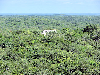
Northern regions are dry, and in pre-modern times were home to desert-dwelling foraging groups. Most of the rest of the country is (or was) covered by forest and jungle, gradually cleared for farming. An exception is the northern portion of the Yucatán peninsula, which is geologically composed of a flat, riverless, limestone plain, where the native vegetation, wherever it is not modified by farming, is low, thorny, scrub forest.
Like the rest of the Americas, Mexico was settled thousands of years ago, although nobody knows for sure how many thousands, and the issue is entwined with the problem of dating the migration of earliest humans into the Americas. Estimates range from as recently as about 13,000 BC to as much as 50,000 BC, in part because the earliest archaeological evidence is difficult to date. By the time of the Spanish arrival in 1519, people lived in all parts of Mexico, and hundreds of languages and dialects had developed. In Spanish eyes, all of these people were initially simply "Indians" or "Mexicans." But in their own understanding, they belonged to hundreds of different groups, interacting of course, but varying in their languages, their ways of life, and their political alliances.
When the Spanish explorer Hernán Cortés arrived in 1519, the Aztec empire dominated the southern half of Mexico (excluding the Maya world), so in this account we shall be concerned only with the various broadly defined ethnic groups that are relevant to their story.
Along the coast of the Gulf of Mexico, roughly the modern state of Veracruz, lived the Huastecs, and slightly south of them the Totonacs. Huastec and Totonac are languages of the widespread Maya language family. These peoples had been conquered by the Aztecs, and they resented it. They eventually became Spanish allies in attacking the Aztecs.
The Valley of Mexico (the area around Mexico City) was inhabited by the southernmost speakers of a huge language family that extended north into modern Utah. At the north end, the Ute and Hopi languages of Arizona and Utah belong to this family. At the southern end, the Aztec language —Náhuatl— belongs to it, and hence the whole language group is given the name "Uto-Aztecan."
The southernmost group of Uto-Aztecan dialects constitute the Náhuatl language, and Náhuatl was far and away the most important language of non-Maya Mexico. Speakers of Náhuatl are referred to as Nahua. Most of the Nahua were conquered by the Aztecs, the most important exception being the Náhuatl-speaking towns of Tlaxcállan (modern Tlaxcala), directly east of Mexico City, and Teotitlan del Camino south of modern Cuernavaca, and their immediate environs.
To the northwest, cutting across the Uto-Aztecan region, lived speakers of Otomí (also called Ñañu). Although eventually conquered by the Aztecs, the Otomí were considered by them to be especially wild and violent. The most violent group of Aztec warriors were therefore also called otomí.
Along the south (Pacific) coast, in the mountainous area of the modern state of Oaxaca, lived speakers of Zapotec and Mixtec, who eventually succumbed to Aztec domination.
To the west of the Valley of Mexico lived speakers of Tarascan (also called Purépecha), who were not conquered by the Aztecs, although they were threatened. (The Tarascans won the decisive battle and the Aztecs grudgingly left them alone after that.)
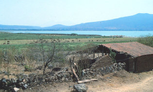
Far to the north, in the desert regions, lived people whom the Aztecs referred to as Chichimecs ("dog people"). Some were foragers ("raw dog people") and some practiced dry horticulture ("cooked dog people"). The Aztecs admired the toughness of these desert dwellers, and claimed that they themselves were descended from Chichimecs who moved south. We don't know what language the early Chichimecs spoke. It may well have belonged to the Uto-Aztecan group, but probably was not Náhuatl. Whatever language their Chichimec ancestors may have spoken, by the time the Aztecs were at home in the Valley of Mexico, they spoke Náhuatl, just as most other Valley of Mexico peoples did. Perhaps in the course of a long and slow migration they intermarried with Náhuatl speakers. Or perhaps their claim on Chichimec ancestry was a falsified account, aimed at stressing their toughness and ability to survive against all odds, for these were the Chichimec qualities that the Aztecs especially needed and admired.
| « Part 1 |
Contents Glossary, Bibliography | Part 3 » |