locations (113K)
topo maps (965K)
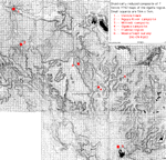
Topographic maps from Series Y742 -- East Africa (Tanzania) 1:50,000. The gridlines are at 1km intervals, and are numbered using a coding system that allows one to identify locations to within about 100m (by interpolating). Since these scans rarely include the borders (hence codes), the current images cannot be georeferenced that way; if there is any actual demand for adding gridline coordinates let me know and I'll upgrade them. Note that the green areas on the maps indicate "forest" while the unshaded is almost all "woodland"; these classifications are rough and based on the mapping photographs only. Within any single map they tend to be fairly accurate ("forest" patches are generally more dense than "woodland" and more likely to contain evergreen trees) but I am not convinced they are consistent across maps -- e.g., they should not be relied upon to compare Mahale and Ugalla.
These images are intended to be useful if downloaded and manipulated/printed; hence in most cases they were scanned at 200dpi and are very large -- some main images exceed 2MB. If this system proves impractical let me know and please suggest alternatives. "Ugalla" covers more than 1,000 km2 (for perspective: count out a 3x12 grid of cells on one of the Ugalla maps; Gombe National Park would fit within it). To scan all the maps at 200dpi would come to roughly 75MB; not practical. If you are particularly interested in detailed coverage of an area that does not appear in these scans, please let me know the coordinates you'd like and we'll work something out.
If you have any trouble downloading any images, let me know and I will see what I can do.
|
|
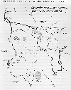
| Tanzanian site locations (113K) |
Ugalla overview topo maps (965K) |
Vertical mapping aerial photographs (from which these maps were made) are available for most of these sites via the main Ugalla page.
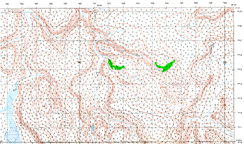 |
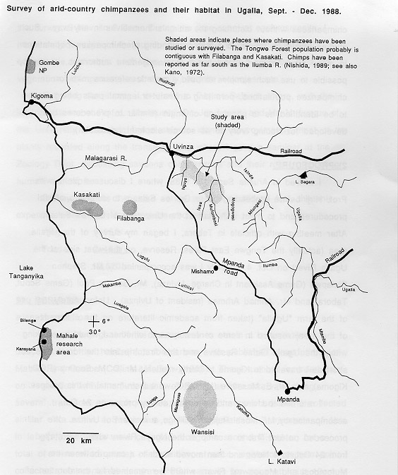
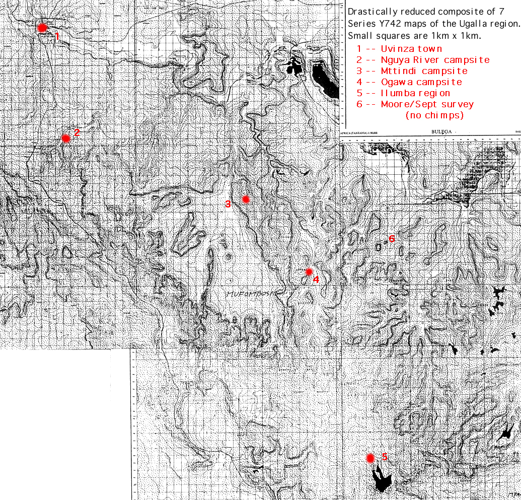
Mttindi area #1 (1.7MB) The Mttindi area (my own name for it, after a campsite) is one of the two places I have focused on. The campsite (at a spring) is a short walk from "Samaki Valley", site of a seasonal small lake (with delicious catfish). The main "study region" is entirely encompassed by this map (the lake is the small blue spot just left of bottom center; the campsite is about 2.5km to the left (they are indicated on the enlarged version). | 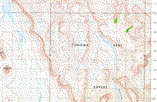 |
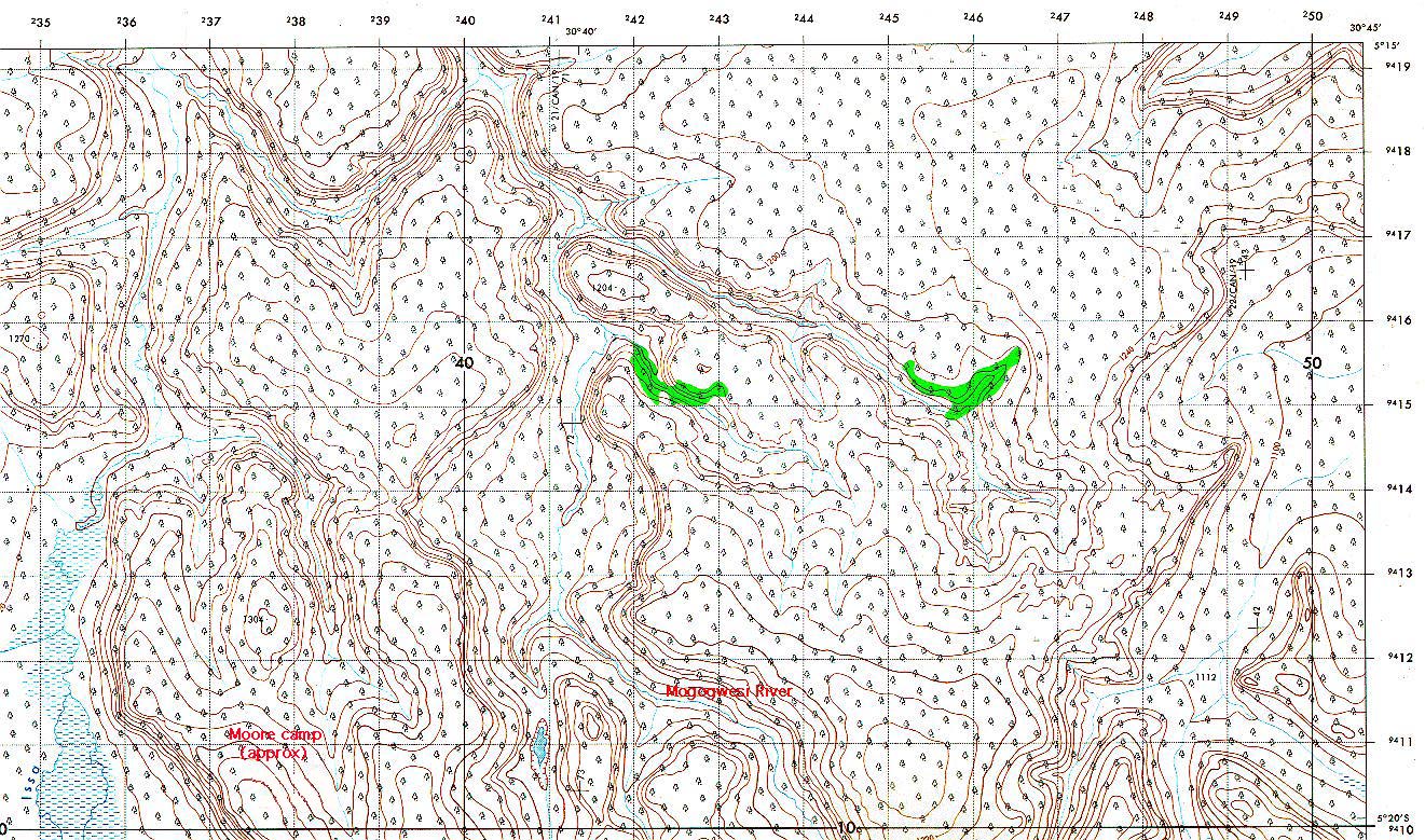
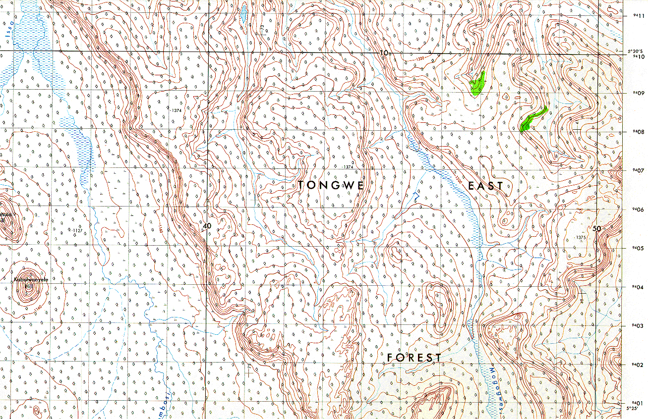
Mttindi area #2 (1.9MB) This map covers an area I have only entered a couple of times, but it is included because it connects up the Mttindi area with the general location of Hideshi Ogawa's camp on the Mogogwesi River (the river on the right; see #3, below). I suspect that chimpanzees use much of the shallow valley running south from Samaki Lake as well as the Mogogwesi. | 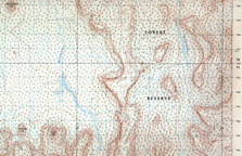 |
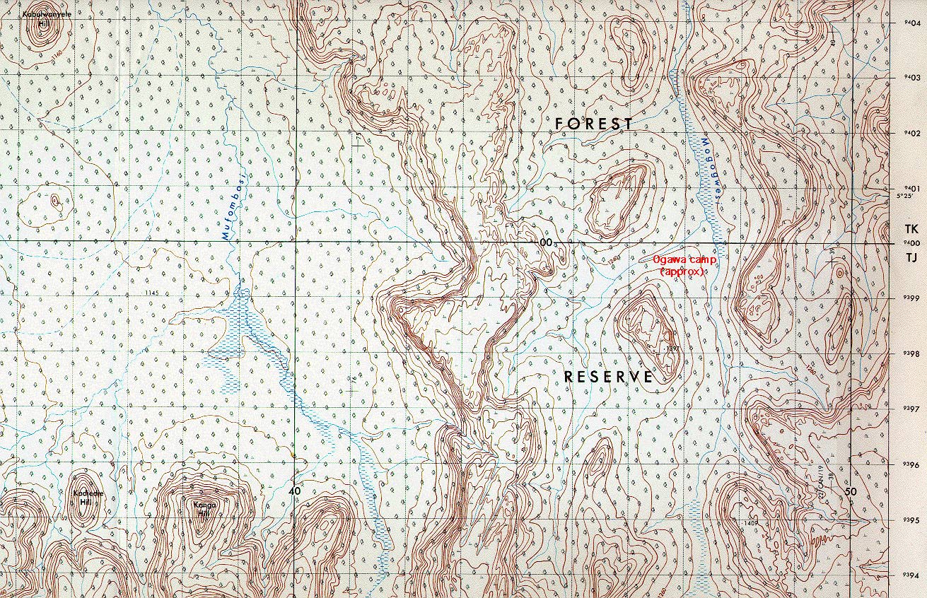
Mttindi area #3 (1.7MB) This frame includes Ogawa's camp area (right side). All three Mttindi images here are from the 1:50,000 Series Y742, Sheet 114/3 "Mufombosi", Edition 1-TSD map. |
 |
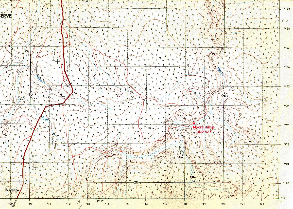
Nguya River area (1.8MB) This area is much closer to Uvinza (about a 6 hour walk) and is the main "entry" point for honey collectors and loggers coming in from town. Nevertheless, chimpanzee nests are regularly located within about 3km of the campsite (indicated on the enlarged version). 1:50,000 Series Y742, Sheet 113/2 "Uvinza", Edition 1-TSD |
 |
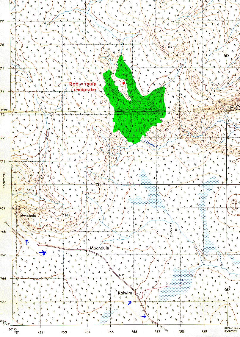
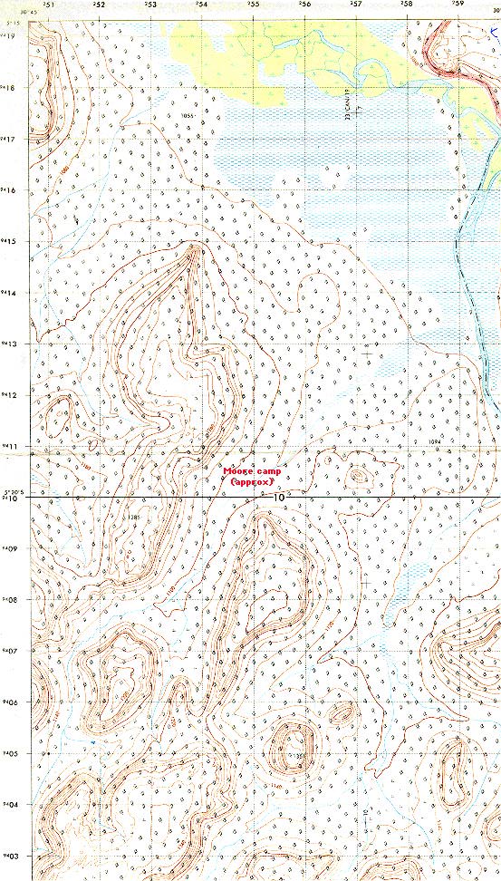
The Ilumba area (1.4MB) is far to the south (see "regional overview" map above). I visited it because the map indicates an unusually large patch of "forest". Although this turned out to be an exaggeration (there was somewhat more ?Cynometra forest there than other areas, but it was patchy, not the continuous forest suggested by the map), chimpanzee nests were reasonably abundant. The forest area contains the headwaters of the Ilumba River. 1:50,000 Series Y742, Sheet 133/2 "Mpandule", Edition 1-TSD |
 |
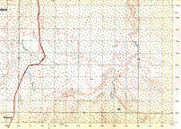
Bulega area (948K) I selected the area shown (from the "Bulega" map sheet) for investigation on the basis of the multiple hills (usually favorite nesting areas), which would hopefully permit testing of suggestions in the literature that chimpanzees prefer particular orientations for nesting. After exhaustive survey, the bottom line is that chimpanzees do not appear to use the region; in several weeks I found only a few, very old, nests. This suggests that the limit to chimpanzee distribution is not the Ugalla River (shown), but some quantitative function of habitat quality that this region falls just barely below. Sounds like an interesting thesis project!! Perhaps related, this was the only area in which vervet monkeys were reasonably common (in the flats near the Ugalla River). 1:50,000 Series Y742, Sheet 114/2 "Bulega", Edition 1-TSD |