Content created: 1996-03-03
File last modified:
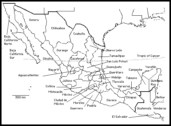
Most works on Mexican archaeology do not provide maps showing states or their boundaries. Most inexpensive student atlases also leave Mexican state boundaries unmarked. If you print this map out, it should fit comfortably on a notebook page.

The following abbreviations are sometimes used to represent these states:
|
AGU = Aguascalientes BCN = Baja California Norte BCS = Baja California Sur CAM = Campeche CHH = Chihuahua CHP = Chiapas COA = Coahuila COL = Colima DIF = DF = Distrito Federal (Ciudad de México) DUR = Durango GRO = Guerrero GUA = Guanajuato |
HID = Hidalgo JAL = Jalisco MEX = México MIC = Michoacán MOR = Morelos NAY = Nayarit NLE = Nuevo León OAX = Oaxaca PUE = Puebla QUE = Querétaro ROO = Quintana Roo |
SIN = Sinaloa SLP = San Luís Potosí SON = Sonora TAB = Tabasco TAM = Tamaulipas TLA = Tlaxcala VER = Veracruz YUC = Yucatán ZAC = Zacatecas |